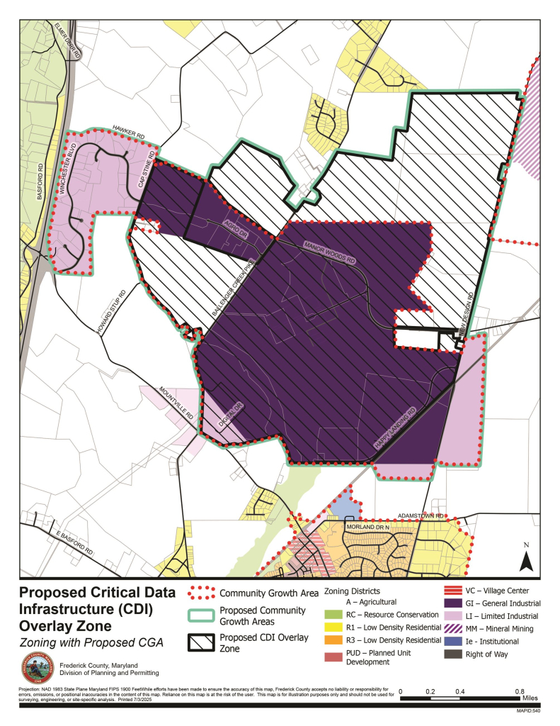
It would limit these facilities in or near the former Eastalco site in Adamstown.

Frederick, Md (KM) A proposed overlay map describing where data centers can be located in Frederick County was released this week by County Executive Jessica Fitzwater. She said it would limit these facility to about 2,500 acres in and around the former Eastalco plant in Adamstown.
“Frederick County residents have been clear: we will accept reasonable, well-regulated data center development. But we will never accept the sprawl we’ve seen in Northern Virginia,” Fitzwater said during a presentation of this map.
She said map limits data centers to less than one percent of the county’s totals landmass. And for every one acre turned over to data center development, five acres will be reserved for farmland preservation. “The map proposed keeping data center development away from Carroll Manor Elementary School. And under legislation moving through the Council process, data centers will not be allowed within 500 feet of residential neighborhoods,” Fitzwater said.,
These provisions in the overlay map are similar to the legislation introduced into the County Council. It was unveiled in early May by County Executive Fitzwater and all seven members of the County Council.
This overlay map is expected to go before the County Planning Commission on Wednesday, July 16th for review. Fitzwater says it will also go before Maryland state agencies for a 60-day review. “After the state review, the Planning Commission will have another opportunity to review the map and hear from the public before they send it to the County Council,” says Fitzwater. “The Council will then hold its own public hearing before bringing the map up for a vote.”
Throughout this process, Fitzwater said citizens will have every opportunity to provide their input. “This is a transparent public process, with ample opportunities for you to make your voice heard,” she said.
By Kevin McManus